Company
Bohemia Interactive Simulations (BISimTM) is a global software company at the forefront of simulation training solutions for defense and civilian organizations. We use the latest game-based technology and a large, experienced in-house team of engineers to develop high-fidelity, cost-effective training and simulation software products and components for defense applications.
2001
Bohemia Interactive Simulations founded in Australia
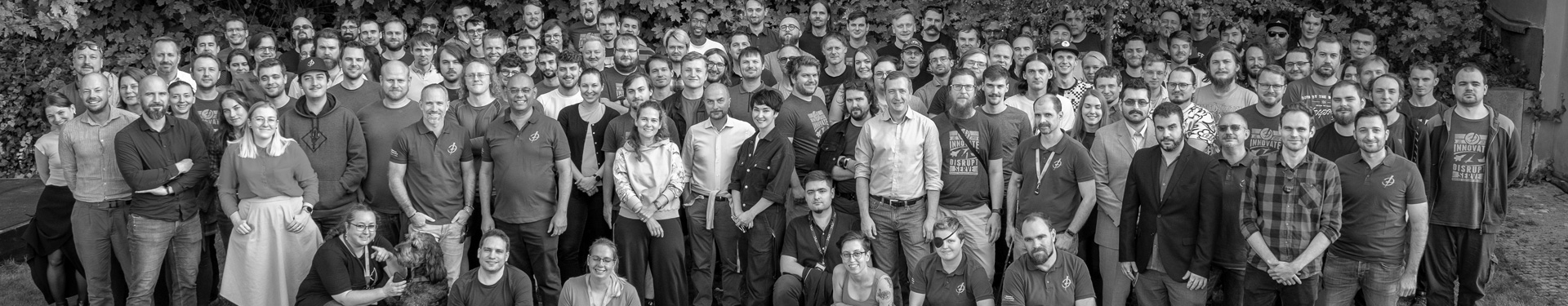
300+
Employees across offices in the U.S., UK, Czech Republic, Germany, Poland, and Australia
50+
Defense organizations worldwide use BISim products to train personnel
Company DNA
Innovation. Disruption. Humility.
We strive to innovate by inventing new products and improving existing ones. We strive to disrupt both the markets we serve and by challenging our products and ways of working. And we act with humility in all we do – our customer is always king, good ideas have no hierarchy and today’s technology can be yesterday’s technology tomorrow.
Mission
Our mission is to harness the explosive potential of technology to revolutionize training and simulation.
Values
We believe if we live by these values, success will naturally follow.
Common Vision
We have a common strategy and set of values.
Self-healing Organization
When we come across an issue, we fix it for the short and long term. We are open to change and value continuous improvement.
Rigorous
Everyone takes responsibility to make sure nothing ‘falls through the gaps.’ We are action and conclusion oriented.
Place to be Proud of
We believe achievement is the route to a satisfying job. We strive to be goal and deadline oriented but also a satisfying and fun place to work environment.
Respectful
We treat others as we expect to be treated. We communicate our feedback in a concise, supportive and empathetic manner.
Challenging
We challenge each other to perform better and expect high quality in everything we do.
Pragmatic
As an organization, we are decisive. We always look for compromise and the best outcome for the company based on the available facts.
Vision
To deliver cutting-edge simulation products and technology to meet complex training needs, facilitating ease-of-use and rapid, cost-efficient scenario generation for both governmental defense organisations and defense industry customers by:
Partnership
Staying close to our customers so that their requirements remain at the center of everything we do
Growth
Maintaining and growing a highly responsive, skilled and experienced development team
Disruption
Striving to be disruptive in both our technical innovation and business
Innovation
Investing in independent R&D to push the boundaries of innovation beyond short-term
Research
Constantly scanning the wider technology landscape to find innovative solutions to leverage and integrate into our existing software
Community
Fostering an active user community around our technology to share ideas, feedback and the cost of software development
Open-Minded
Serving non-defense industries with complex simulation training needs, but only to drive further innovation and positively impact our primary (military) customer
Quality
Supporting our products/technology through timely delivery of the highest quality professional services
Explore Careers at Bohemia Interactive Simulations
Fun and relaxed isn’t the opposite of goal and deadline oriented — we strive to be both. Our company offers staff more than just cash and benefits — we offer a good work environment, a lot of feedback, mentoring, and training.
Leadership
BISim’s leadership team represents decades of experience drawn from military service, the modeling and simulation sector, information technology and software development, and entrepreneurship.

Rahul C. Thakkar
President
Rahul joined BISim as President in July 2023. He focuses on charting growth to enable the expansion of BISim’s portfolio and is responsible for the overall strategic direction and day-to-day business operations. He is in charge of assessing key domestic and international markets to pursue new opportunities for BISim’s portfolio of products.
An Academy Award® winner and inventor on 50+ patents, Rahul is a seasoned technology leader with experience in cloud computing, defense and intelligence, aerospace, geographic information systems (GIS), and media and entertainment. He most recently served as the director and general manager of Simulation Technologies at Amazon Web Services (AWS), where he led the development of services that made it easier for simulation engineers, scientists, and technicians to scale their simulations on AWS. Prior to AWS, he served as the Director of Infrastructure Transformation at Boeing, where he led various enterprise infrastructure transformation efforts and built cloud-based capabilities for their unmanned systems. Rahul also had a long history of building foundational technologies for visual effects in feature films such as Antz and Shrek (winner of the 2002 Academy Award® for Best Animated Feature Film). In 2016, he won a Technical Achievement Academy Award® for “the groundbreaking design of the DreamWorks Media Review System.”

Pete Morrison
Chief Commercial Officer
Pete was one of the founders of Bohemia Interactive Simulations (BISim) in 2007. Pete is now BISim’s Chief Commercial Officer (CCO). As CCO, Pete is responsible for strategic initiatives to drive business growth, and he supports both product development and sales efforts. Pete is an evangelist for the use of game technologies and other COTS-type products and software in the simulation & training industry.
Before BISim, Pete studied Computer Science and Management at the Australian Defence Force Academy and graduated with first class honors in 2001. Pete had previously graduated from the Royal Military College, Duntroon, into the Royal Australian Signals Corp. He served as a Signals Corp Officer for several years, specializing in military simulation, and his final posting was to the Australian Defence Simulation Office (ADSO) as a Project Officer.

Ian Applebee
Chief Financial Officer
Ian joined Bohemia Interactive Simulations as Chief Financial Officer in 2022. He oversees the Group’s global financial operations with responsibilities including financial planning, reporting, treasury and tax. Ian is focused on the expansion of BISim capabilities through the continuation of profitable growth.
Prior to BISim, Ian spent 15 years in different businesses of BAE Systems gaining international corporate financial management experience. In various leadership roles, he acquired important insight into commercial software sales and government procurement processes. Ian has a bachelor's degree in Finance and Accounting from Ithaca College and an MBA from Georgetown University.

Oliver Arup
Chief Product Officer
Oliver is product manager for VBS3 and all desktop training software in Bohemia Interactive Simulations as well as being a director of the UK office.
Prior to establishing the UK office of BISim in 2011, Oliver worked at QinetiQ for seven years in several roles, starting his career as a developer working on vehicle crew system software, before becoming a systems administrator and simulation engineer for QinetiQ and Boeing Defence UK. Oliver then became the lead COTS (Commercial off-the-shelf) simulation engineer for QinetiQ working on delivering training to MOD customers using VBS2 and other tools. Oliver’s work with VBS2 ranged from the delivery of in-service training systems, to the development of CCDs (Capability Concept Demonstrators). These CCDs showed the use of VBS2 and other COTS products to deliver training traditionally delivered by high-cost bespoke systems. A constant component of Oliver’s roles was research and development, taking new software and hardware techniques and assessing their suitability in training solutions.
As a result of this work, Oliver was seconded to Niteworks (a UK government research and decision support agency) to work as the Technical Lead on several of the MOD’s training transformation programs which looked at filling training needs using modern COTS-based technology.

Eva Saravia
Chief Operating Officer
Eva serves as Senior Vice President of Global Programs with responsibility for the Global Program Management Office and the overall successful execution of programs for Bohemia Interactive Simulations worldwide. Her areas of responsibility include both customer funded projects and Internal Research and Development (IRAD) projects.
Eva joined Bohemia Interactive Simulations, Inc. in 2013 after a successful career with Northrop Grumman where she was instrumental in the development of the United States Air Force Distributed Mission Operations capability, the US Army AH-64A Combat Mission Simulator Upgrade, as well as serving in a variety of leadership roles. Eva has a bachelor’s degree in Biomedical Engineering from Boston University, a master’s degree in Engineering Management from the University of Central Florida, is a certified Project Management Professional, and has an extensive background in Lean Six Sigma and Agile Project Management.

Ryan Stephenson
Group General Counsel & Managing Director, Australia
Ryan is the General Counsel for the Bohemia Interactive Simulations group of companies and is also the Managing Director of Bohemia Interactive Australia (BIA). In 2010, Ryan became General Counsel for the Bohemia Interactive Simulations group of companies, and in January 2011 was also appointed as Managing Director for BIA, the Asia-Pacific arm of the group, where he is helping to consolidate and build on the stellar growth and success that Bohemia Interactive Simulations has seen in the past few years.
Ryan is an intellectual property and commercial lawyer specializing in technology and media-related work. Having originally trained and worked in the UK, Ryan is also admitted to practice in New South Wales. Ryan has extensive experience as a commercial lawyer in intellectual property-focused environments both as an in-house counsel and in private legal practice.
Ryan spent the first five years of his career as an in-house lawyer for two of Britain’s leading television production companies. Since moving to Australia in early 2003, he has worked both in private legal practice and as in-house counsel, broadening his areas of practice to encompass work in software, technology and new media licensing and exploitation, and honing his existing commercial and IP-related skills and knowledge.

Rusmat Ahmed
SVP Sales, EMEA and Asia
Rusmat joined BISim in 2014 and leads all sales and business development activities in Europe, the Middle East, Africa, and Asia.
Following a military flying career, Rusmat worked for Racal and Thales in business development, strategy, and bid and project management roles. He ran business units in civil and military avionics, and was project or operations director on successful, large multi-company projects. Moving increasingly to customer-facing roles, he was a sales director at L-3 before joining BISim. The common thread through all of Rusmat’s customer-facing activities has been to bring innovation and clearer benefits to customers’ global solution needs. Rusmat has an MBA from INSEAD France, and a degree in economics from the University of York.

Craig Brower
Senior Vice President of U.S. Sales
Craig joined BISim in June 2023 as Senior Vice President, U.S. Sales. He is responsible for identifying and developing new business opportunities, nurturing key partnerships, and driving revenue growth in U.S. defense markets.
Craig is an experienced national security executive with a background in disruptive geospatial intelligence technologies such as 3-dimensional (3D) modeling, artificial intelligence, machine learning, and real-time geo-registration. In March 2015, he was instrumental in the launch of Vricon Systems, a disruptive technology company specializing in high-accuracy 3D global data using satellite imagery. Craig was in charge of all sales, business development, and marketing in the United States, as well as key partnerships in the international defense and intelligence markets. Vricon was acquired by Maxar Technologies in 2020, highlighting his achievements in the industry even further.

Ryan Binns
Chief Architect
Ryan is the primary technical authority within the BISim development organization. He works closely with the VP of Engineering to manage the software design and architecture of BISim's portfolio of simulation and training products. Ryan leads a talented group of BISim's software architects and experienced senior developers in designing the highly performant, scalable, realistic, and innovative technologies that power BISim's flagship VBS4, VBS3, and VBS Blue IG products.
Ryan joined BISim in 2017 after more than 10 years of working as a software engineer and team lead in both the gaming and simulation and training industries. Previously, he served as the development product lead for the VBS Blue IG and VBS SDK products, collaborating with industry partners and software integrators to deliver highly customized training solutions.

Alistair Miggels
Vice President, Engineering
Alistair directs the development organization responsible for delivering the technical solution to all customer and internationally funded development projects within BISim. He leads a highly professional development team of over 150 technical staff. Alistair and his team have a keen ability to successfully deliver complex technical solutions under aggressive deadlines that far exceed customer expectations.
Alistair joined BISim in 2017 after several years working in the defence industry on constructive simulation and command and control systems tightly integrated with virtual simulation systems. He has a wealth of knowledge and experience gained from working as a Development Product Lead for VBS4 and Product Manager for virtual desktop trainers, giving him an extensive understanding of the underlying technologies of BISim products.

Earl Laamanen
Product Manager, Geospatial
As Technical Director at TerraSim, a role Earl has held since 2014, Earl is charged with overseeing the integration between TerraSim and other parts of BISim as well as working as an intermediary between TerraSim and BISim in joint development projects.
Earl began his career with BISim in 2004 in Australia, where he worked as a 2D and 3D Artist on VBS1 and soon became Lead Artist for VBS2. When BISim moved to Prague, CZ he followed and transitioned to Project Director and helped lead development projects for VBS2 and VBS3. Most recently, Earl has moved from Prague to Pittsburgh to take on a new role as Technical Director at TerraSim, Inc., a BISim-owned company.
His work in managing and improving the VBS development tools has provided him with significant experience in terrain generation and 3D modeling. His addition to the TerraSim team is the first step towards a tighter integration between TerraSim and BISim products, which will provide an improved experience for BISim and TerraSim customers alike.